HCDE 596A directed research, Winter 2026
FIFA World Cup 2026 Transit Wayfinding
A physical walkway guide for visitors with no data plan and no time to learn a new transit system.
- My role
- UX Researcher and Wayfinding Designer
- Timeline
- Winter 2026
- Team
- Alefiya Haveliwala, Ashlesha Hadkar, Nene Murao, Justis Peppin. HCDE 596A, University of Washington.
- Note
- Academic research. A Sound Transit PM took part as a research subject, not a client.
01
The problem
The World Cup brings roughly 68,000 visitors a match into a transit system built for people who already know it. Many will not read English comfortably. Many will be navigating without a working data plan.
How might we improve the visibility and clarity of on-foot wayfinding from Sound Transit stations to Lumen Field, without relying on a network connection?
02
Who we designed for, and what the field found
We designed around one persona: Natasha, 29, from Belgium, in Seattle for her first match. Limited English, staying downtown, riding Link Rail alone.
I need something I can hold in my hands that shows me where to go.
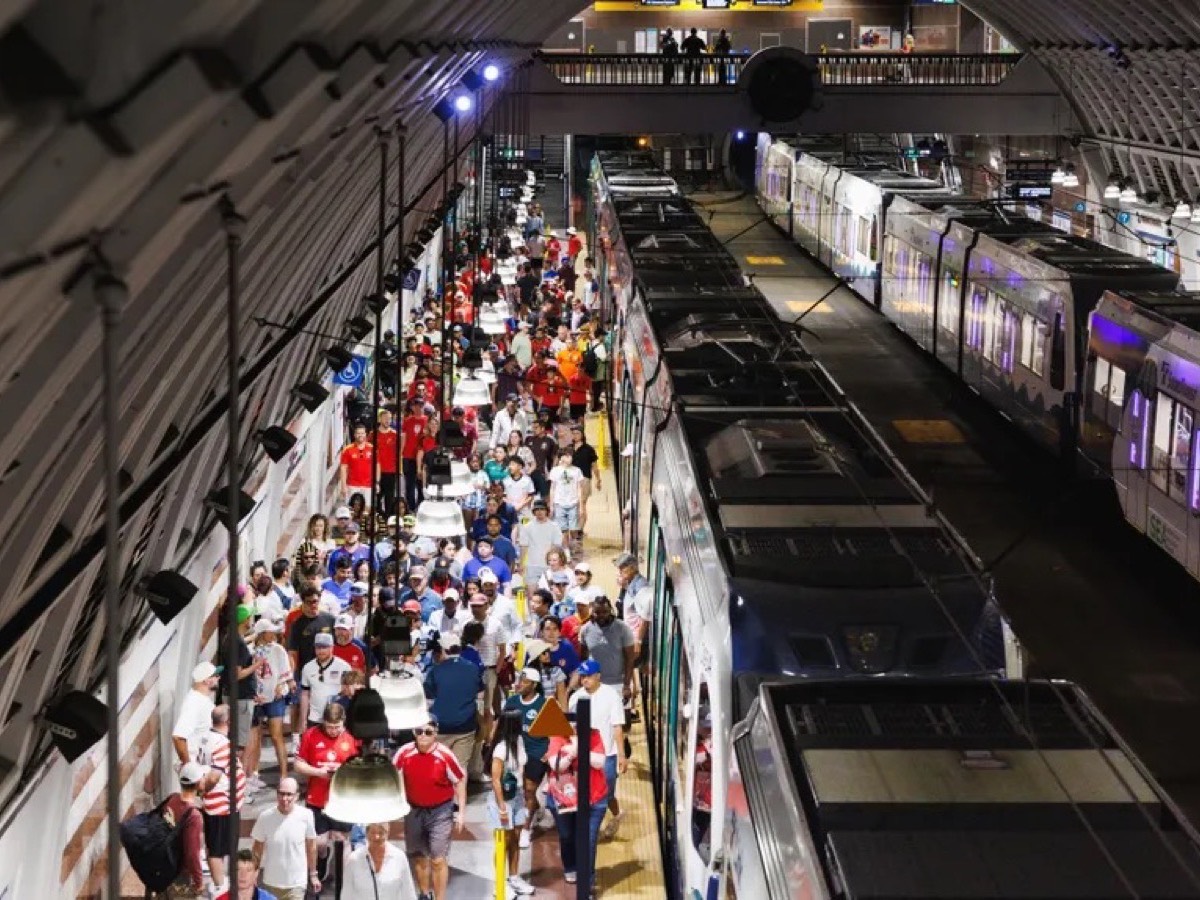
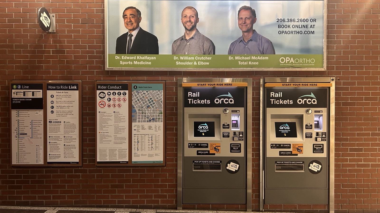
Natasha, persona built from our interviews and secondary researchTo find where she would actually get stuck, I ran field research at a Seahawks game, the closest Seattle gets to a World Cup crowd, before and after kickoff on January 17, 2026. International District Station was dangerously overcrowded, shoulder to shoulder on the stairways. Pioneer Square, two blocks over, was nowhere near as full, and no physical map existed anywhere to tell visitors that. I also interviewed a Sound Transit Project Manager as a research subject, which gave us the constraints: what Sound Transit controls, what it does not, and what could realistically ship before the tournament.
The finding that reframed the brief: most attendees already know how to use transit. Riders from Europe, the Middle East, Australia, and major US cities use rail and metro at home. The gap was not transit literacy. It was Seattle specific routing under a language and connectivity constraint.
03
Borrowing what already worked
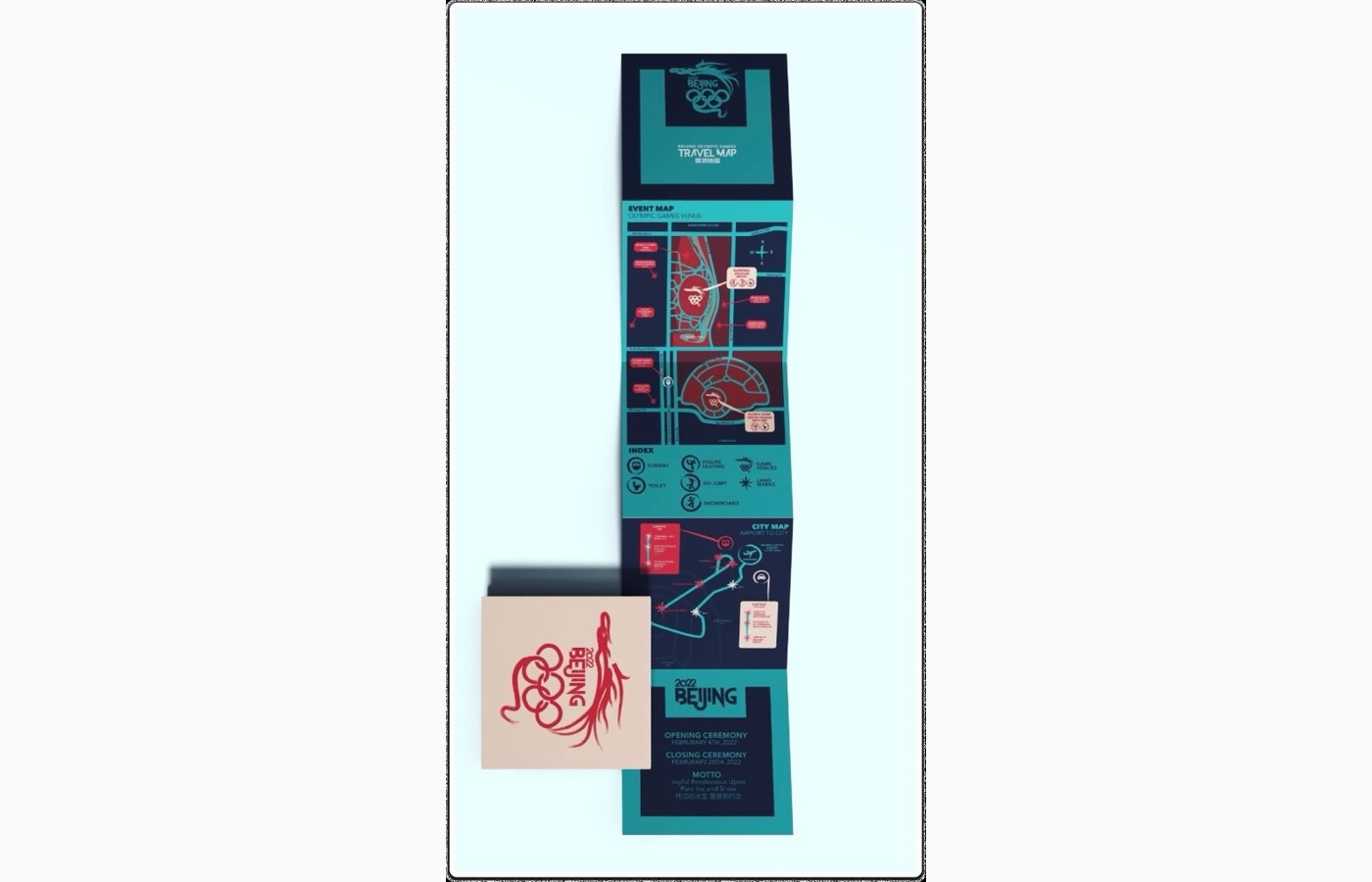
Rather than invent a visual language, we studied the Beijing 2022 and Paris 2024 Olympics wayfinding systems and adapted what worked.
- Official branding up topBecame Sound Transit branding, for instant credibility.
- Simplified geography over GPS accuracyBecame station to stadium walking routes.
- Icon based indexBecame multilingual transit and accessibility icons.
- Color blocking for hierarchyBecame color coded routes with time estimates and ADA information built in.
04
What we explored and cut
A one quarter timeline meant choosing one deliverable and building it well instead of five at the surface. We explored more before narrowing.
- Decision
- Cut information booths and kiosks.
- Why
- Staffing and station infrastructure were beyond what a student team could scope or hand off.
- Tradeoff
- No staffed touchpoint, only a printed artifact a visitor carries with them.
- Decision
- Cut gamification: stamps, collectible cards, incentive based wayfinding.
- Why
- Field notes pointed to one clear gap, physical maps, not an engagement mechanic.
- Tradeoff
- A less novel deliverable, but one grounded directly in what we observed.
05
The walkway guide
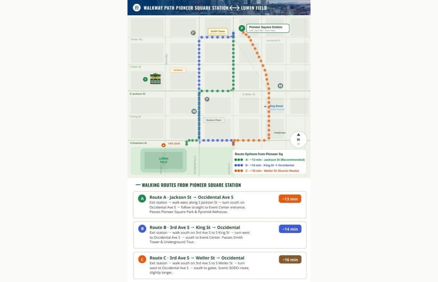
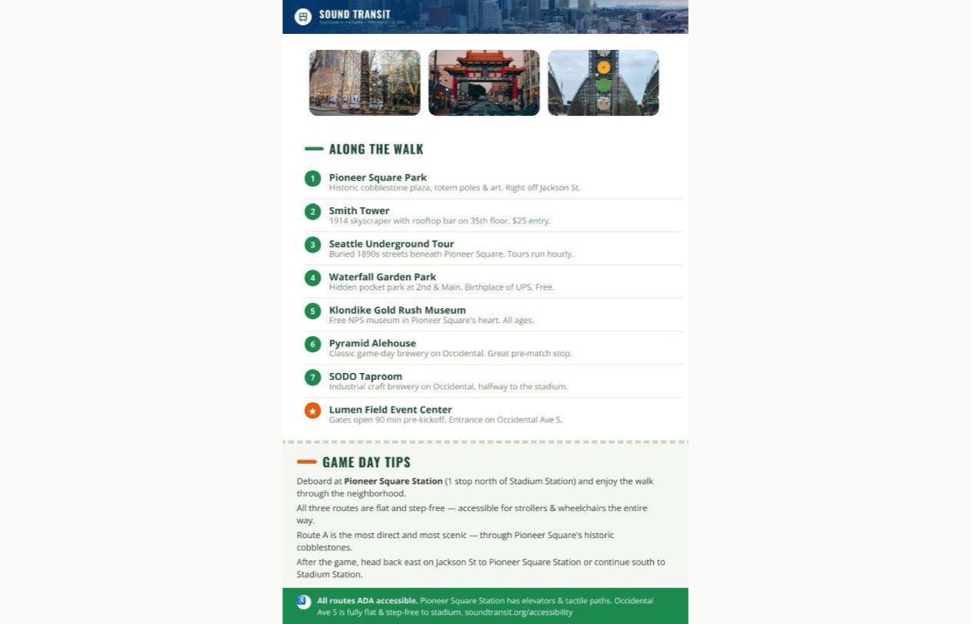
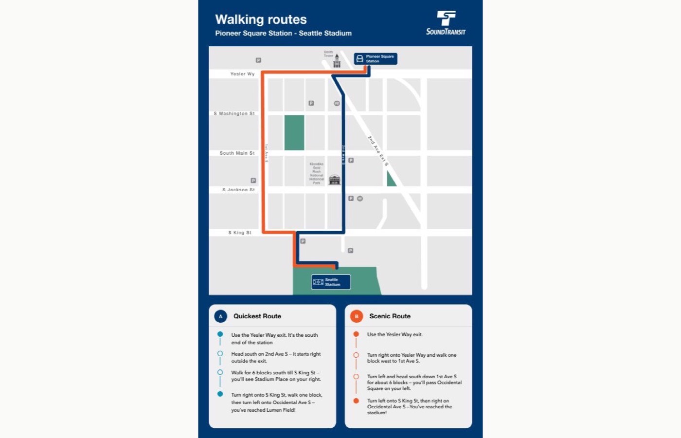
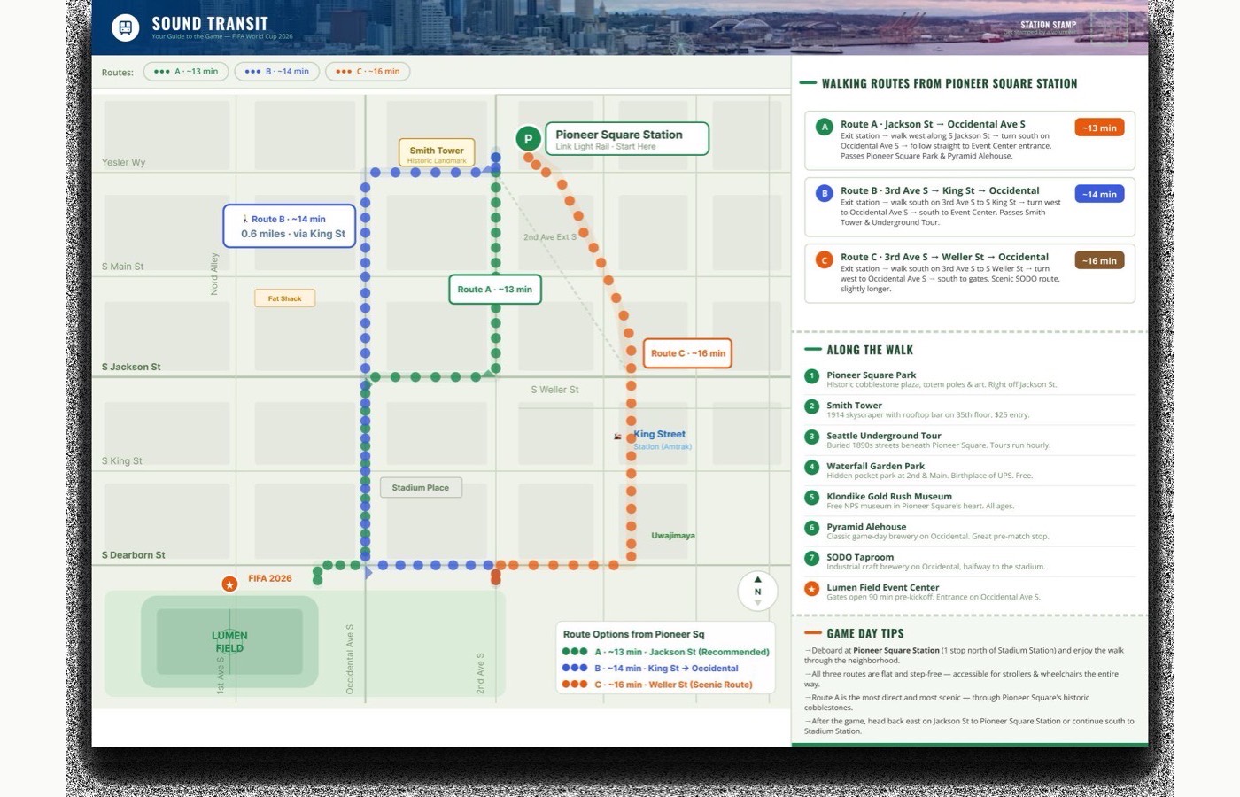
One physical guide, two sided, in three station variants.
-
01
Map side
Two sided print, three station variants
Color coded walking routes from the station to Lumen Field, each carrying a time estimate.
-
02
Tips side
Points of interest, station info, QR handoff
Routes the visitor to Sound Transit's own channels, so the guide works offline and the agency keeps ownership of live updates.
-
03
Distribution set
Pioneer Square, Stadium, International District
Pioneer Square is the recommended route. Field research showed it was significantly less congested than the other two.
Every route is flat and step free, ADA accessible the entire way.
06
From structure to brand
The guide went through two passes. V1 tested hierarchy and decision flow against the field research, structure before styling. V2 applied Sound Transit's official color palette and matched the Link Line color coding, which is what actually got it taken seriously by stakeholders.
07
Where it stands
This was academic directed research, not a paid client engagement. The Sound Transit Project Manager took part as a research subject, and the guide is a concept grounded in field observation and one stakeholder interview, not an adopted deliverable.
Success was defined narrowly on purpose: visitors choosing a route from the map instead of following the crowd, fewer bottlenecks at the International District station, and travelers reporting a stress free walk to the stadium. All three are observable in the field, not just claimed in a report.